Do-it-Yourself Rides
Healthy Riding during the Lock Down
We have 9 tested routes available with maps and turn-by-turn guides. A map with all 9 routes is here: https://bit.ly/3fEf2rg. Scroll down for details of all rides.
Note that another good ride is the Thames Path route on the south of the river from Tower Bridge to Battersea Park. This is normally too busy to allow steady progress. But now, it is really great. Cycled at the start of the first lockdown from Potters Fields to Battersea Park in just over 30min. Mind you, it was 7am. On a fine morning London has never looked better.

Solo, Duo or Bubble Healthy Riding
Take some photos and post them with comments to the Facebook group, Southwark Cyclists Healthy Rides, https://www.facebook.com/groups/553896211918871/. If you have not joined this group yet, please do. Note that further information will also be on the Southwark Cyclists web site, southwarkcyclists.org.uk/healthy-rides/do-it-yourself-hrs/
Take some photos and post them with comments to the Facebook group, Southwark Cyclists Healthy Rides, https://www.facebook.com/groups/553896211918871/. If you have not joined this group yet, please do. Note that further information will also be on the Southwark Cyclists web site, southwarkcyclists.org.uk/healthy-rides/do-it-yourself-hrs/
Short Ride 1. Canal, River, Woodland and Docks
A short (4 mile), flat ride around the Rotherhithe Peninsula. Designed to be ridden clockwise, but works anti-clock as well. Be nice to pedestrians, please, as it is nearly all off-road on shared paths. Start in Deal Porter Square next to Canada Water Library (or anywhere else on the loop as it suits you). Map at https://bit.ly/3aceO7A. GPX route file below. Plus a detailed turn-by-turn guide.
A short (4 mile), flat ride around the Rotherhithe Peninsula. Designed to be ridden clockwise, but works anti-clock as well. Be nice to pedestrians, please, as it is nearly all off-road on shared paths. Start in Deal Porter Square next to Canada Water Library (or anywhere else on the loop as it suits you). Map at https://bit.ly/3aceO7A. GPX route file below. Plus a detailed turn-by-turn guide.
|
| ||||
Short Ride 2. Dulwich and its Castle.
5.5 mile ride around Dulwich. Some gradual uphill at the start. Mostly on quiet roads. If Dulwich Park is still closed, start at College Gate, opposite the Dulwich Picture Gallery. Start at Dulwich Clock Café (closed) (but hopefully the toilets are still accessible). Warm up by doing an anticlockwise circuit of this fine park. As you will realise from the map, with this route crossing and re-crossing itself it is easy to shorten it if required. But do not miss the Castle. It is fun, and the setting, midst a post-war estate is bizarre. Map at https://bit.ly/2QJzf3Z. Detailed route guide and GPX file below.
5.5 mile ride around Dulwich. Some gradual uphill at the start. Mostly on quiet roads. If Dulwich Park is still closed, start at College Gate, opposite the Dulwich Picture Gallery. Start at Dulwich Clock Café (closed) (but hopefully the toilets are still accessible). Warm up by doing an anticlockwise circuit of this fine park. As you will realise from the map, with this route crossing and re-crossing itself it is easy to shorten it if required. But do not miss the Castle. It is fun, and the setting, midst a post-war estate is bizarre. Map at https://bit.ly/2QJzf3Z. Detailed route guide and GPX file below.
|
| ||||
Ride 3. Telegraph Hill and Nunhead Cemetery
4.5 mile loop. Mostly quiet streets and path. Steep uphill in Telegraph Park. Many will walk steepest bits – they are short though, and worth it for the views back to Central London. Nunhead Cemetery is highly atmospheric and is one of the “Magnificent 7” early Victorian cemeteries in London. Route map at https://bit.ly/2xnVeXD. Detailed navigation guide below.
4.5 mile loop. Mostly quiet streets and path. Steep uphill in Telegraph Park. Many will walk steepest bits – they are short though, and worth it for the views back to Central London. Nunhead Cemetery is highly atmospheric and is one of the “Magnificent 7” early Victorian cemeteries in London. Route map at https://bit.ly/2xnVeXD. Detailed navigation guide below.
|
| ||||
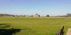
Short Ride 4. Burgess and Southwark Parks. 8.6km (5.2 miles). Pretty much flat.
|
| ||||
Short Ride 5. Canada Water to Cutty Sark. 10.7km (6.4 miles). Flat.
|
| ||||
Route 6. Dulwich to Brixton Mill
5.6 mile ride that takes you to a working windmill. As well as the mill the ride passes Brixton Prison and goes through Brockwell Park twice. Route map at https://bit.ly/3cHZYqu. GPX route file and detailed navigation guide below.
5.6 mile ride that takes you to a working windmill. As well as the mill the ride passes Brixton Prison and goes through Brockwell Park twice. Route map at https://bit.ly/3cHZYqu. GPX route file and detailed navigation guide below.
|
| ||||
Route 7. Dawsons Hill and a Golf Course on a Reservoir
This is a hilly route, but not too long (4.5 miles). Takes you to a great viewpoint – but the path down is STEEP, so make sure your brakes work! Then we go to the Aquarius Golf Course. The ride also makes a small diversion to the Horniman Museum. Route at https://bit.ly/3ayBkXv. GPX route file and detailed navigation guide below.
This is a hilly route, but not too long (4.5 miles). Takes you to a great viewpoint – but the path down is STEEP, so make sure your brakes work! Then we go to the Aquarius Golf Course. The ride also makes a small diversion to the Horniman Museum. Route at https://bit.ly/3ayBkXv. GPX route file and detailed navigation guide below.
|
| ||||
Route 8. Burgess Park to Vauxhall Bridge
Flat 5 mile circuit, out via Imperial War Museum and Vauxhall Pleasure Gardens and back via Oval Cricket Ground and Kennington Park. Note that as with all the routes, you can start anywhere. Recommend doing the route anti-clockwise. Route at Google maps, https://bit.ly/3bWq5d1. GPX route file and detailed navigation guide below.
Flat 5 mile circuit, out via Imperial War Museum and Vauxhall Pleasure Gardens and back via Oval Cricket Ground and Kennington Park. Note that as with all the routes, you can start anywhere. Recommend doing the route anti-clockwise. Route at Google maps, https://bit.ly/3bWq5d1. GPX route file and detailed navigation guide below.
|
| ||||
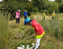 Looking for butterflies, Ruskin Park
Route 9. Camberwell Open Spaces
Another route starting centrally in Peckham Square next to Peckham Library. 6 miles and not quite flat. A circular route more or less staying in Camberwell. It runs through a series of open spaces, some large like Burgess Park, some very small like Elam Street Open Space and Sceaux Gardens. In between always on quiet streets. Choose a sunny day if you can and enjoy our beautiful parks, large and small. Route map at https://bit.ly/2Ake0QZ. GPX route file and detailed navigation guide below.
Another route starting centrally in Peckham Square next to Peckham Library. 6 miles and not quite flat. A circular route more or less staying in Camberwell. It runs through a series of open spaces, some large like Burgess Park, some very small like Elam Street Open Space and Sceaux Gardens. In between always on quiet streets. Choose a sunny day if you can and enjoy our beautiful parks, large and small. Route map at https://bit.ly/2Ake0QZ. GPX route file and detailed navigation guide below.
|
| ||||
